Natural disasters can happen anywhere, at any time, with little warning. Many instigate significant damage within cities and communities disrupting critical infrastructure, making the ability to plan for and manage these events very important. Aerial imaging and mapping has emerged as a valuable tool in disaster management. In the event of a fire, hurricane, tornado, flood, or landslide, is your community prepared?
What to do before:
One thing that is valuable for effective disaster management planning, providing insight for response, recovery, and future preparedness is having high-resolution aerial photos with high-density lidar scans on record. The combination of the two allows for the most detailed documentation of existing conditions of the landscape, infrastructure, and environment.
- Planning: Detailed aerial mapping helps identify high risk areas that are vulnerable to flooding or landslides, prepare mitigation strategies, and draft emergency plans, procedures, or safe alternative routes.
- Insurance: Pre-disaster imagery and Lidar help validate claims and determine the extent of damage or potential negligence.
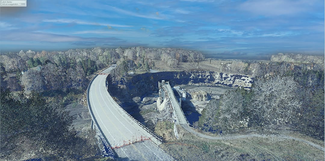
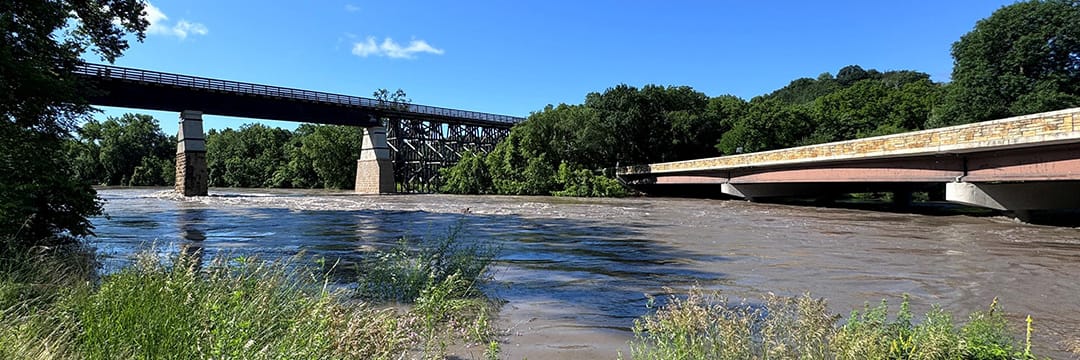
95West combined aerial images with lidar data to create a three-dimensional model to document the damage from the Rapidan Dam failure on the Blue Earth River from the extreme rain event and flooding in June 2024.
Actions After a Disaster:
Documenting the affected area as soon as possible after a natural disaster is crucial. Aerial photos combined with lidar scans provide a direct comparison of environmental conditions before and after the event.
- Change Detection: Over time, changes in the landscape can significantly impact drainage, transportation, wildlife, and municipalities. Comparing historical terrain data can identify hazards and project trends.
- Disaster Response and Recovery: Aerial data helps emergency responders quickly assess the hardest-hit areas, identify road blockages, and plan logistics for delivering aid.
- Environmental Impact: Aerial photos help track changes to the environment, such as deforestation, soil erosion, or changes in waterways. This data is useful for long-term environmental management and planning.
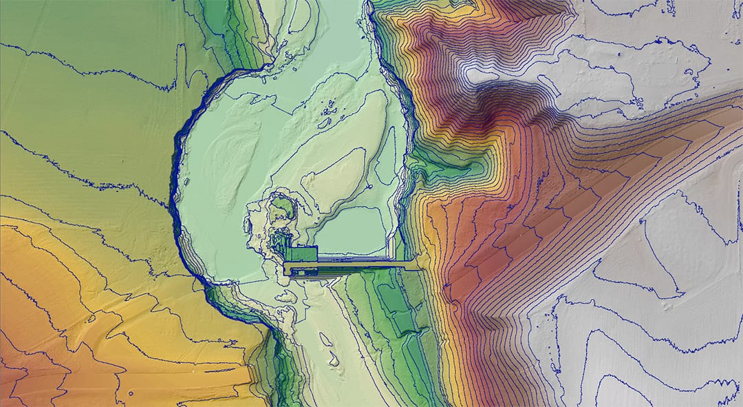
95West colorized the lidar data with five-foot topography lines to create a hillshade map of the area. A hillshade map simulates the effect of light and shadow to make a flat map look three-dimensional.
Who Needs These Images and Information?
Various organizations and professionals may require aerial photos:
- Government Agencies: National, state, county, watershed districts, lake associations, and local city or townships often conduct aerial surveys for disaster planning and response. Agencies like FEMA or local disaster management authorities may arrange for pre-disaster aerial imaging.
- Insurance Companies: Some insurance companies may commission aerial imagery to assess risk and document the state of properties in vulnerable areas before a disaster strikes.
- Environmental and Research Organizations: Research institutions and environmental groups often take aerial photos to monitor environmental changes, providing valuable data for disaster planning and impact assessment.
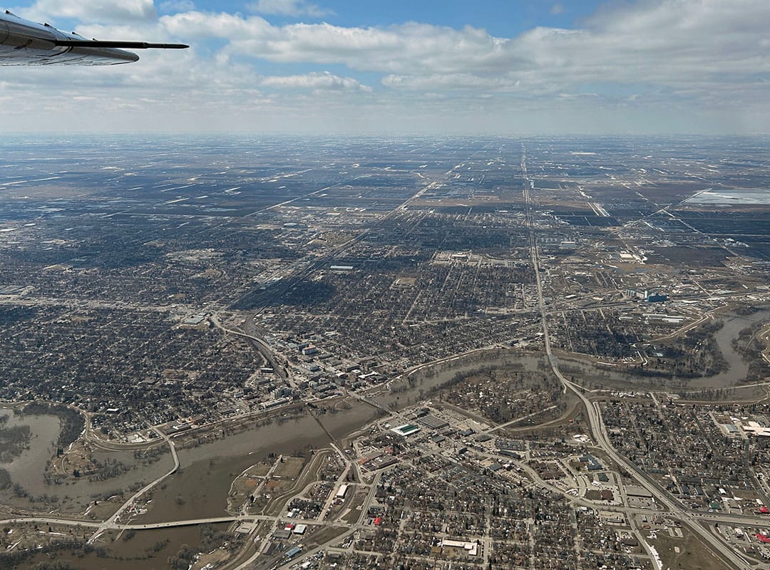
95West’s flight team documented the extent of the flooded area of Grand Forks and East Grand Forks during the Red River flood of April 2023.
Even though there may not be flooding from this spring’s minimal snow cover and melt, you can still have aerial imaging completed now to better document existing conditions and be prepared for future natural disasters.
 banner 960x360")


